|
|
|
Kinyon Digital Library |
Civil War Rosters |
| Home || What's New? || Notes || Census Data || Data By State || Military Records || Links || Items For Sale || Poetry | |
|
|
|
|
Kinyon Digital Library Copyright © 1999-2013, |
A. T. Andreas
|
|
Iowa Index || - || Andreas Index || Crawford County Index |
||||||||||||||||||||||||||||||||||||||
|
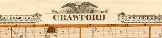
Crawford County Map - 1875
A. T. Andreas Illustrated Historical Atlas of the State of Iowa, 1875
To preserve detail and maintain file size, the Crawford County map has been divided into 20 township maps. Each township map may be accessed from the table below. The table also shows those counties which border Crawford County.
|
||||||||||||||||||||||||||||||||||||||
|
||||||||||||||||||||||||||||||||||||||
|
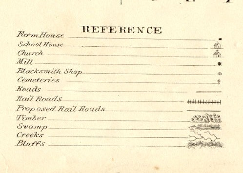
Legend used for the Crawford County map:
|
||||||||||||||||||||||||||||||||||||||
|
Iowa Index || - || Andreas Index || Crawford County Index |
||||||||||||||||||||||||||||||||||||||
|
Home || What's New? || Notes || Census Data || Data By State || Military Records || Links || Items For Sale || Poetry |
|||||
|
Site Statistics By
since 17 December 1999. |
|
||||